Nature


"Nature is the medium in which life transpires,"
Scott Russel Sanders on Wendell Berry.


Wednesday, July 20, 2011

Day 13: San Pasqual Battlefield SHP, Fort Tejon SHP, and Tule Elk State Reserve

15 June, 2011

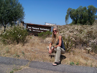
I arrived at San Pasqual Battlefield State Historic Park and discovered that it is only open on weekends; it was Wednesday.

According to the State Parks website, San Pasqual Battlefield SHP serves not as a memorial to war but as a reminder of the "human ideals, actions, and passions" that lead to war.

The park is located at the site of one of the most devastating battles of the Mexican-American War. The battle took place on December 6, 1846 and had no clear outcome.
The park holds living history events in which the battle is re-enacted and the public can enjoy period crafts and music.

To get a better idea of what these events entail checkout Battlelines, a bimonthly newsletter put out by the San Pasqual Battlefield Volunteer Association.

To get to my next destination, Fort Tejon SHP, I drove past the rolling hills that are home to many Indian reservations, through the beautiful and delightfully overcast Oceanside, San Diego, and crawled through the blistering heat and smog of LA.

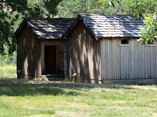
Fort Tejon State Historic Park is located directly off of I-5 along the Grapevine. The Fort is a grim and necessary reminder of the European conquest of California and the United States; it was created to control local Indian populations.

As I wandered about the buildings and other displays in the 102 degree heat, I noticed the heaviness of the uniforms worn by the soldiers; they appeared to be made mostly of wool with long sleeves, long pants, and tall boots. I also took note of the sour and disgruntled look of most of the Europeans depicted in the images, and wondered if the Europeans had dressed more appropriately for the climate would they have been less cranky?
I left Fort Tejon after dousing myself in a sprinkler and headed off to Tule Elk State Reserve in Buttonwillow.

Once again, I found myself withering along 1-5 in the tenacious summer heat with a plethora of welts from mosquito bites begging to be scratched beneath sweat softened skin. One of the most intriguing phenomena about travel and adventure is the apparent amnesia we have about the inevitable suffering we experience during our adventures; the delight we take in relaying said suffering to others post-trip, and finally, craving the suffering and heading out again.

The first time I visited Tule Elk State Reserve it was as a scientific aide for the Department of Fish and Game. At that time the reserve was very dry because the agency in charge of the water had diverted it elsewhere. With the temperature at its high for the day (103 degrees), I pulled into the shaded parking lot of the reserve which was much cooler than I expected. The area now looked like Tule Elk habitat with marsh and reeds and maintained a delightfully cool temperature because of the presence of the water which had been returned to the reserve since my last visit.

Tule Elk were nearly extinct when Henry Miller, a rancher, began the effort to preserve the species in 1874. The elk are managed by the California Department of Fish and Game, but housed all over the state. They can be found at the Tule Elk State Reserve and at Point Reyes National Seashore among other places. I wonder what will become of the herd here? Does the closure of this park effect Fish and Game, and if so , how?

Without my binoculars I was forced to use the zoom of my camera (perhaps with better results) to find the elk. It took a minute, but eventually I made out some funny looking sticks on the horizon…


Day 12-13: Palomar Mountain State Park,


14-15 June, 2011

To get to San Diego, I traveled through the San Bernardino National Forest. The rock formations fascinated me. From a distance, the mountains looked like giant rounded boulders covered in dark green moss; angles and formations of light gray rock jutted out abruptly in all directions from behind the green. This intense beauty lasted until the smog burned my eyes, and a thick layer of brown capped the lower atmosphere on the horizon demarcating the density of the region’s "civilization".

Lush and cool, my stay at Palomar Mountain provided relief from the harsh splendor of the desert. The road to Palomar Mountain State Park moves quickly from near sea level to 5500 feet and offers spectacular views to passengers; I don't recommend sight seeing for drivers. The road keeps the tight turns coming. The southwestern side of the mountain appears to have seen a fire somewhat recently as there is little brush and fire scarred trees.

The campsites at Palomar Mountain State Park are shaded and family friendly. I found a lush spot under some chatty acorn woodpeckers. In fact, the birds in the park were numerous and boisterous almost to the point of cacophony.


I lounged and scribbled in my journal under the shade of the trees until the mosquitoes became too numerous and I retired to my tent to read. To my delight, I discovered coin operated showers and two quarters rolling about the floor of my car in the morning; I reveled in my 4 minute cold to luke warm shower.

Before heading out for San Pasqual Battlefield State Historic Park, I wandered around the pond and watched a group of little birds splashed with yellow chitter and zip about. Just above the pond the park plays host to an outdoor school for kids who, until four in the afternoon, fill the area with sounds of play.


Monday, July 11, 2011

Day12: Saddleback Butte State Park & Antelope Valley Indian Museum


14 June, 2011

Saddleback Butte State Park is located in Joshua tree territory near Lancaster. By the time I arrived at 11:00 a.m., it was nearly 100 degrees. I looked at the sign for the trail head then up at the exposed butte and back again. The heat crinkled the atmosphere and the complete absence of shade meant no hike today unless I wanted to feed the coyotes and turkey vultures (not a bad funeral if you ask me); however, I decided I am not ready to die just yet. As an alternative, I sat sweltering in the campground under one of the shade and wind shelters constructed and maintained by park staff and poured out several small puddles of water from my gallon jug for the flies with the hope that, perhaps, they would stop accosting me. I daydreamed about spring or fall weather and imagined the view from the top of the butte.

The Joshua trees impressed me with their size and Dr. Seuss-like morphology. The last remnants of the winter’s snow drizzled down mountain tops in the distance like icing on a great rocky Danish. The red rock blazed against the green of the Joshua trees and the deafening blue of the sky.

The scene possessed a likeness to old western movies. If I hadn’t known better, I would have expected to hear the call of a loon. A loon is a water bird whose feet sit so far back on its body (an adaptation for diving and fishing underwater) that if it ends up on land it cannot walk; therefore, the decision of Hollywood film makers to use the loons call as a hallmark of the desert is both hilarious and maddening to bird nerds like myself.

Despite the beauty of the park; it is also extremely harsh. Instead of camping at Saddleback Butte, I decided to move on to Palomar Mountain and the cooler temperatures of San Diego county.

On my way out of Lancaster, I stopped at Antelope Valley Indian Museum State Historic Park just down the road from Saddleback Butte. Unfortunately, the park is only open to the public on the weekends, and school tours on Tuesdays and Thursdays. A brochure for Antelope Valley that I picked up later at Fort Tejon describes an incredible experience, and I longed to walk the paths under the rocky bluff where the museum is located, and learn about the culture indigenous to the area.

Many indigenous cultures hold and maintain thousands of years of ecological knowledge within a variety of traditions. Places like Antelope Valley Indian Museum give us the unique opportunity to discover different ways of understanding the world, retaining knowledge, and interacting with the ecosystems in which we live. If we chose to listen to the knowledge maintained by many of these societies, we could learn a lot about how to survive and make the best use of resources and how to begin to restore specific ecosystems and resources.

A holistic yet unique management approach for each landscape, watershed, or ecosystem is much more conducive to effective land use management than the cookie cutter approach used by bureaucratic systems. When we work inside political systems instead of ecological ones, we tend to generalize in order to simplify and govern;however, our relationship with place is anything but simple. Utilizing the wisdom and knowledge of traditional resource management is one way to rethink our relationship with our local and regional places.

In my conversations with park employees, many of them spoke of the complexity of place as it pertains to parks and the difficulty (or impossibility) of trying to systematically shut "place" down. The people who work in and live in these parks understand the quirks (and there are many) of the buildings, trails, ecosystems, and sewer systems; to just simply stop maintaining them will cause more damage and cost more money in the long run.

Thursday, July 7, 2011

Day 11: Red Rock Canyon State Park (No, It's not on the list)


13 June, 2011

On my way to several parks located in San Diego and Los Angeles counties, I stayed at Red Rock Canyon State Park. Don’t panic, it’s not on the list. I chose to stay at Red Rock because it is an hour closer to home than Saddleback Butte State Park, I love red rock, and this park has been on my list for a long time. This turned out to be a good choice, because I got a late start. As it was, I set up camp in the purple timbre of late evening and gusty winds.

The drive down 99, like I-5, is bleak; it is filled with industry, monocultures, and very little that would qualify as nature or culture, or perhaps more accurately, the relationship between nature and culture here creates the dismal and unimaginative landscape; it is an ecological condition created by the culture living inside that landscape.

As I neared the golden folds of the Tehachapi’s I felt my body relax, and I began to breath smoothly. Despite the harshness of the desert, the experience of the Tehachapi’s feels less stark than the dusty industrial and wholly manipulated valley. The place still maintains a tangible pulse.

Just around the bend of the first few hills, however, a giant wind farm scarred the spine of the mountains as far as I could see. I am a proponent of green energy, but must admit that wind farms construct a colossal and menacing scene. As I sit in my air conditioned house, under my electric light, tacking away at my computer, I question whether we really need to use so much energy. It seems that with all the talk of zero emissions energy that conservation never becomes a serious part of the discussion.

Additionally, so called green energy might be better called zero emissions energy. Green or eco-friendly or any other such terms imply that the technology is actually eco-friendly or at least maintains a neutral effect on ecosystems as a whole because it is zero emissions. This approach and terminology is narrow sighted; it behaves as if climate is the only factor in ecosystem health. For example, dams are on the whole one of the most destructive forms of energy I have come across, yet they are zero emissions. They disrupt the migration of anadromous fish such a salmon and thus destroying fish populations as well as the cultures dependent upon them. They permanently saturate habitat, disrupt vital nutrient and sediment cycles, and interfere with natural pollution filtration systems provided by healthy watersheds…but I digress.

Red Rock Canyon is gorgeous. Although I will not spend much time talking about it since it is not on the list. The night was gusty, but my tent held up—unlike my last trip to Death Valley where my devoted tent fell victim to70 mph gusts. In the morning, I did yoga in under the rising sun and wrote in my journal before breaking camp and heading south for Saddleback Butte.